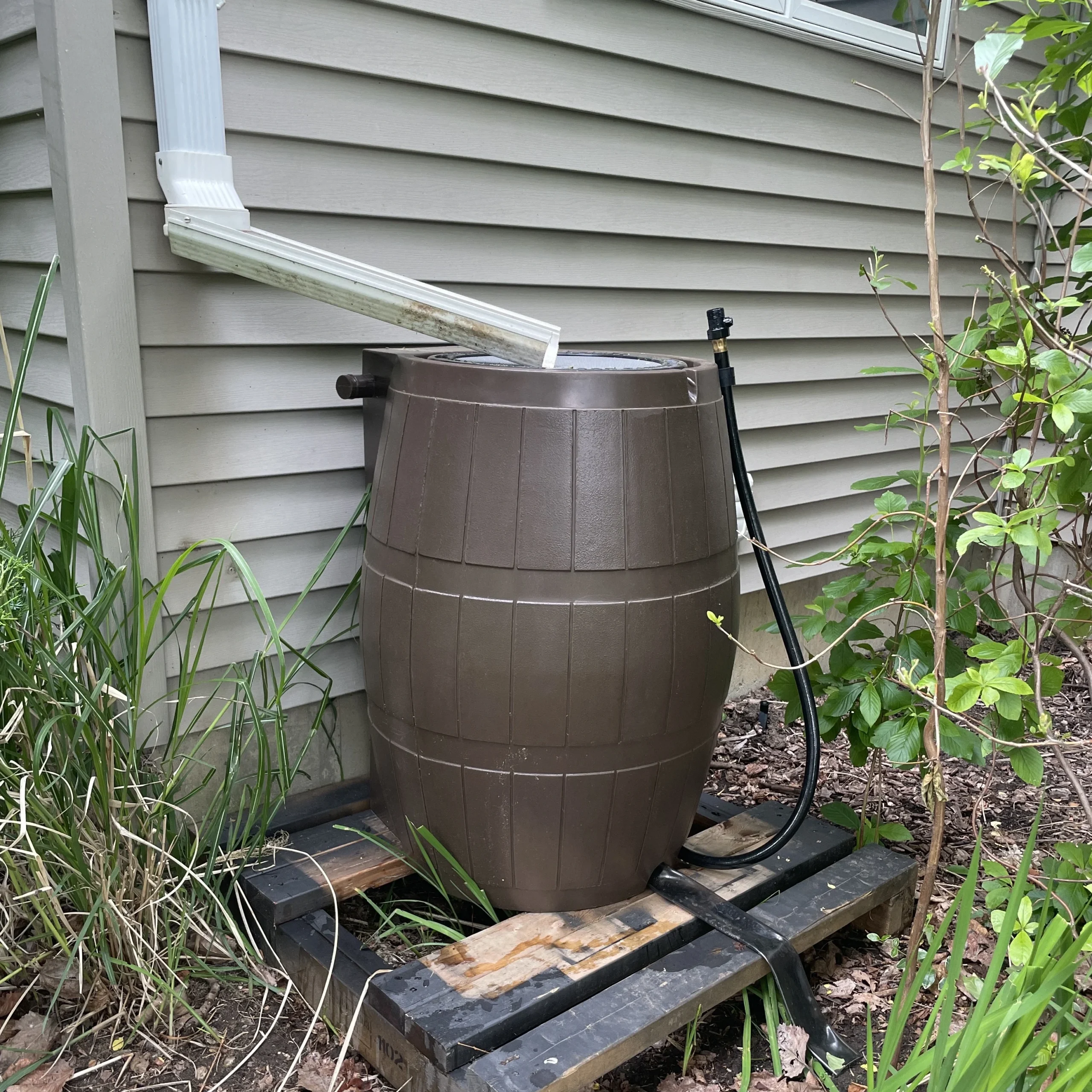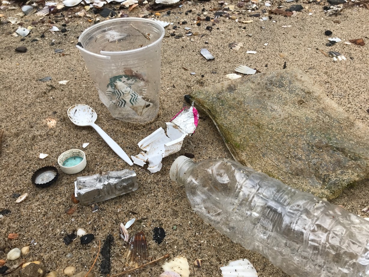
PEP is taking action to reduce nitrogen pollution, harmful algal blooms, pathogens, toxic contaminants, and plastics in the Estuary to support the well-being of people and wildlife.
Share:
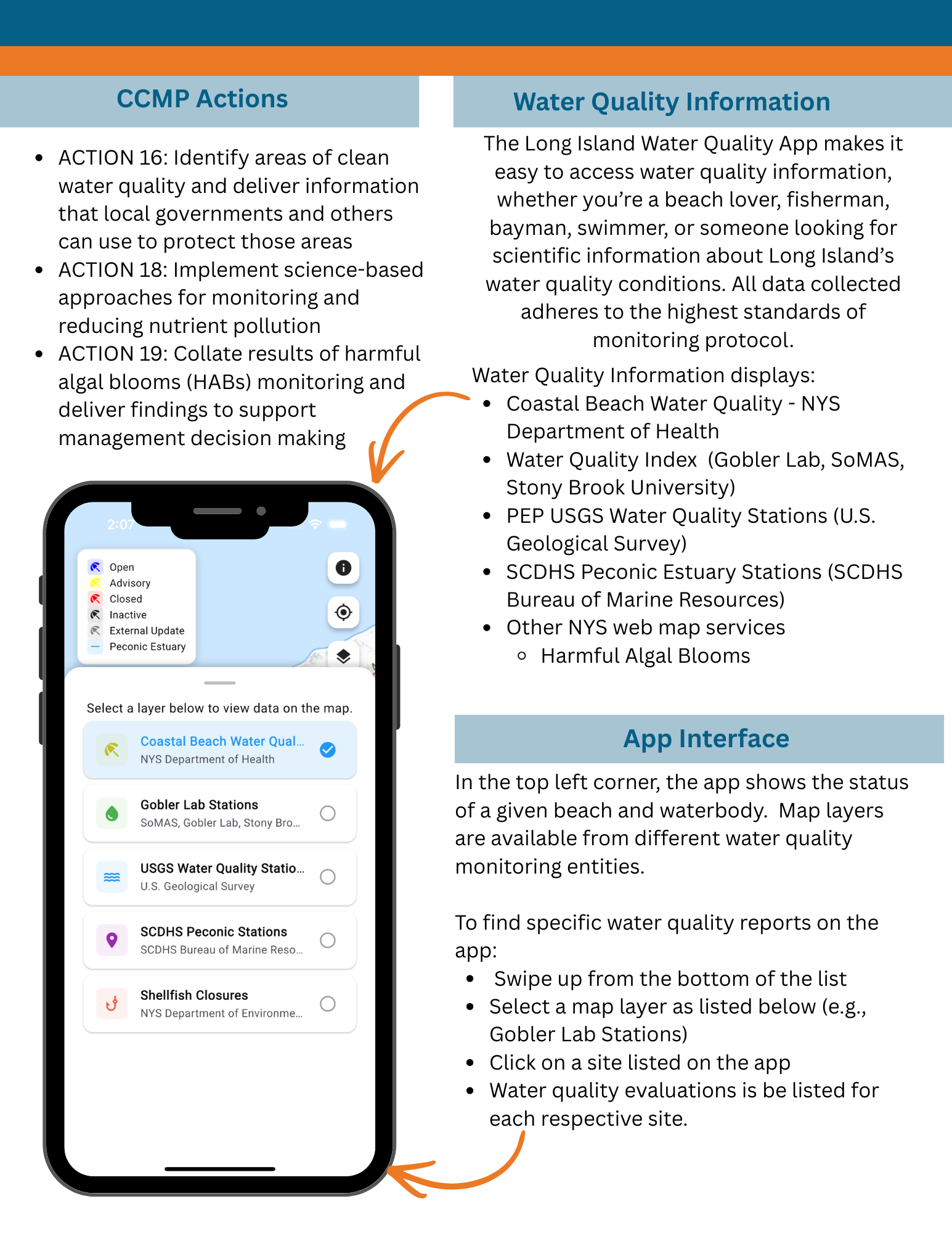
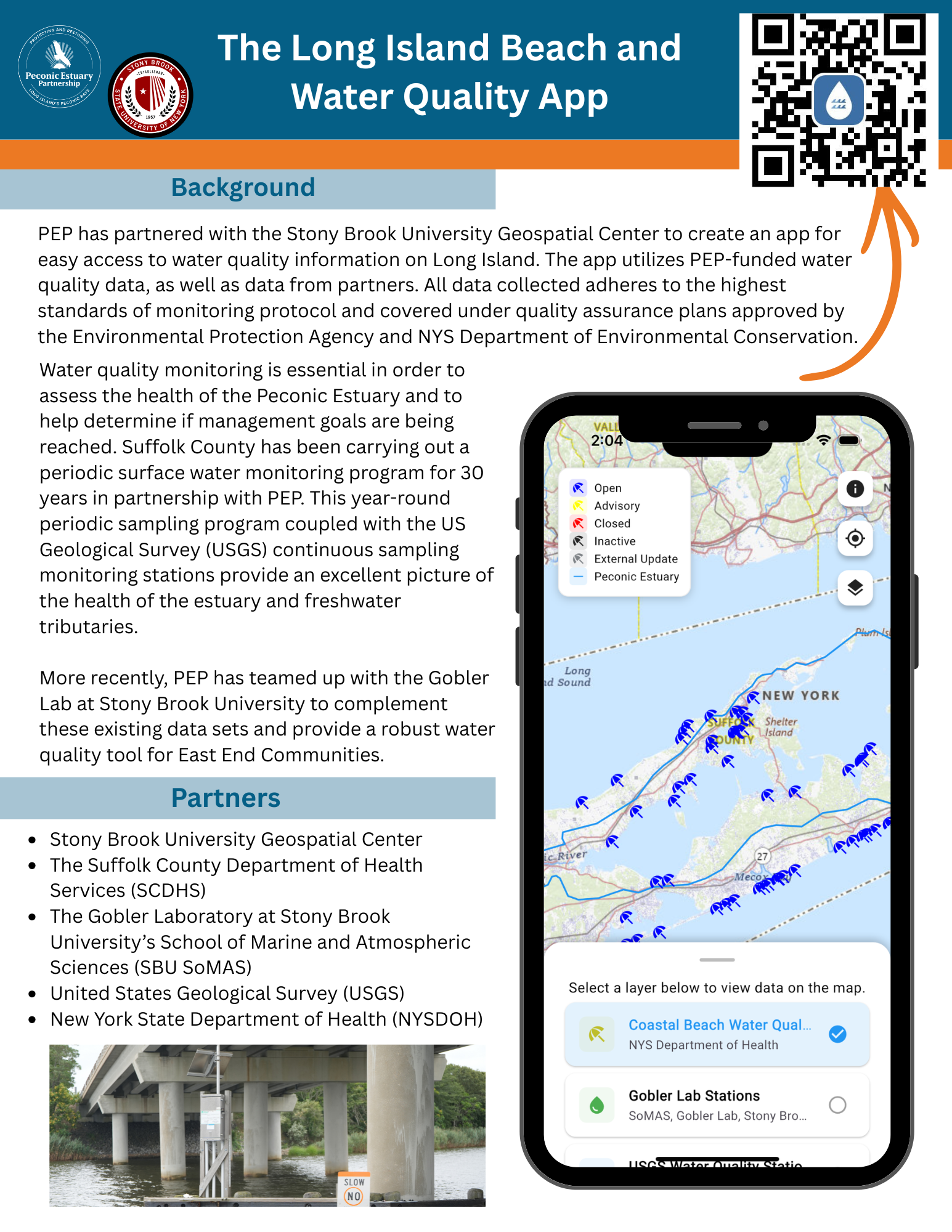
The Long Island Beach & Water Quality App
Peconic Estuary Partnership is thankful for all the partners that have helped make the Long Island Beach and Water Quality app. We are happy to announce that the app has officially launched! Download the app today.
Clean Waters for Ecosystem Health and Safe Recreation
Poor water quality is directly linked to human activities on land. In the Peconic Estuary, the primary sources of nitrogen pollution are wastewater from residential on-site septic systems and cesspools, fertilizers, and storm water runoff, in that order. Nitrogen loading can contribute to harmful algal blooms, low dissolved oxygen, and degraded aquatic habitats. Other pathogens, toxic contaminants, and plastic pollution can also affect water quality and make fish and shellfish unsafe to eat. As part of the 2020 PEP Comprehensive Conservation Management Plan and with advising from the PEP Technical Advisory Committee and Peconic Estuary Water Quality Monitoring Collaborative, PEP created the PEP Water Quality Monitoring Strategy to summarize existing water quality monitoring programs, assess water quality progress towards CCMP goals, and provide next steps to address gaps in data or information. PEP works with a number of partners to monitor the health of the estuary and water quality conditions.
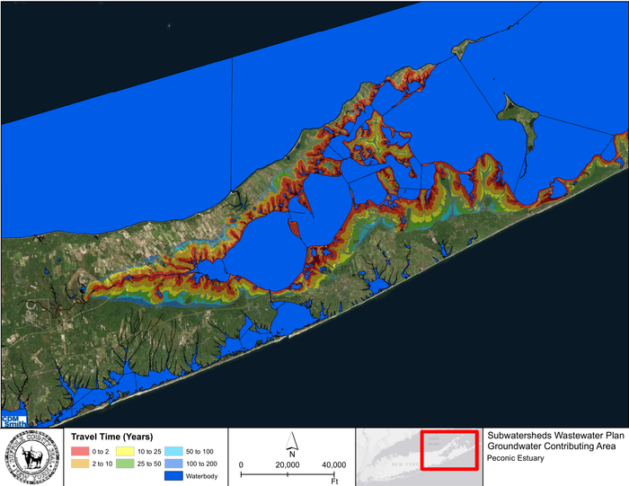
This figure shows the land area that contributes groundwater to the Peconic Estuary, and the amount of time it takes for this groundwater to reach the estuary. The groundwater contains natural and human-made pollutants.
Long Island Aquifer
Long Island Aquifer
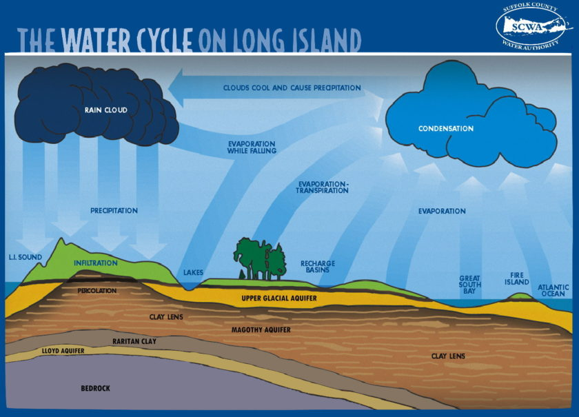
Long Island’s groundwater and drinking water are held below the surface- in a Sole Source Aquifer.
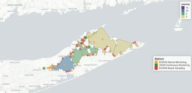
The Peconic Estuary Partnership partnered with Suffolk County and the United States Geological Survey (USGS) to install three continuous water quality monitoring stations within the Peconic Estuary:
Orient Point Harbor
South side of Shelter Island
At the mouth of the Peconic River under the 105 bridge in Riverhead.
Together, these three monitoring systems provide temporal and spatial sampling of water quality in the estuary with data collection occurring every 6 minutes. For more information, see the USGS data for each station, at the Peconic River, Shelter Island, and Orient Point Harbor.
Suffolk County Continuous Water Quality Monitoring Stations
From May through October the NYS Department of Environmental Conservation compiles and provides notifications of known HAB locations in New York State water bodies. NYSDEC also provides information on consistent and temporary shellfish closures. For more information check out the NYSDEC Public Shellfish Mapper – an interactive map showing shellfish closures, conditional harvesting programs, shellfish harvest zones, aquaculture lease sites, and water sampling locations. For the most up to date temporary emergency closure information please call the hotline at (631) 444-0480. A recorded message is available 24 hours a day including weekends. For any other questions call the main shellfish office at (631) 444-0492 during normal business hours, M-F 8:30 AM until 4:45 PM.
Suffolk County Continuous Monitoring Stations
PEP partners with Suffolk County to conduct water quality monitoring across the Peconic Estuary. More information about the monitoring program as well as publicly available data can be found on the Suffolk County Marine Water Quality Monitoring website. SCDHS also conducts a comprehensive bathing beach water quality monitoring program from May through September. A telephone Beach Hotline message (631-852-5822) is regularly updated to reflect any changes in beach status.
WaterTraq, the Long Island Water Quality groundwater viewer hosted by the Long Island Commission for Aquifer Protection, allows water suppliers, health officials, industry professionals, and the public to research contamination by location. Explore these interactive maps to learn more about water quality across Long Island!
Ongoing Water Quality Efforts
Technical Reports and Archived Projects
Check out more information below about ongoing water quality projects, technical reports, and archived projects in the Peconic Estuary
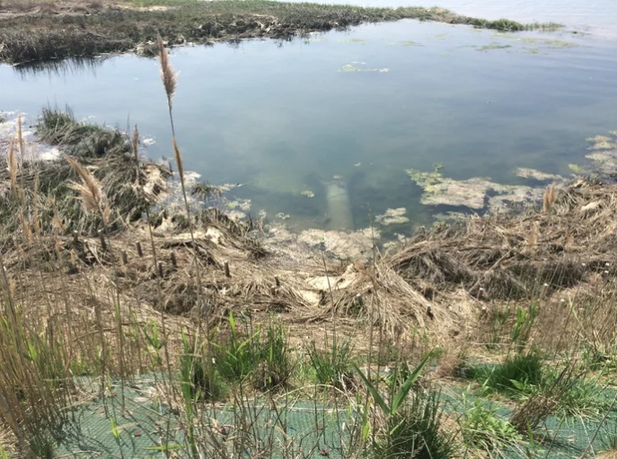
There are many sources of water pollution to the Peconic Estuary, including wastewater, excessive fertilizer usage, pesticides, stormwater runoff, atmospheric deposition, and animal waste.
PEP is funding many projects to help mitigate pollutants from entering the estuary and contaminating the surrounding ecosystem. Plastic pollution and toxic contaminants can concentrate in the environment and negatively affect humans, wildlife, and the environment.
The Peconic Estuary Program State of Estuary Report (2023) The Peconic Estuary Program 2023 State of the Estuary report outlines the goals and objectives to summarize the ecological health of the Peconic Estuary since the Peconic Estuary Program and the work being implemented to protect the surrounding ecosystems.
HAB Action Plan (2017) The Suffolk County Harmful Algal Bloom (HAB) Action Plan was completed in fall 2017. The plan describes the current state of knowledge regarding factors responsible for initiating and sustaining HABs in County waters, along with on-going environmental monitoring efforts and programs.
Long Island Watershed Plan (formerly known as LINAP) Long Island Watershed Plan (formerly known as LINAP) is a multiyear initiative to reduce nitrogen in Long Island's surface and ground waters by DEC, the Long Island Regional Planning Council (LIRPC), and Suffolk and Nassau counties, with input from multiple partners and stakeholders.
Suffolk County Subwatersheds Wastewater Plan Suffolk County took a historic step forward in ongoing efforts to better protect both groundwater and surface water through the development of a countywide wastewater upgrade strategy. The Suffolk County Department of Health Services finalized the Subwatersheds Wastewater Plan (SWP) in 2020. The SWP is a rigorous, science-based roadmap for transitioning away from reliance on conventional cesspools and septic systems, which are the primary source of nitrogen pollution that has fouled local bays.
A Reclaim Our Water initiative, the strategy documented in the Suffolk County SWP was developed in partnership with the Long Island Nitrogen Action Plan (LINAP) and in collaboration with numerous project partners, stakeholders, and technical experts. The SWP is the product of years of intensive research, documentation, modeling, and evaluation of all of Suffolk County’s water resources and provides a parcel-specific roadmap on how to address the nitrogen crisis through wastewater upgrades and other nitrogen pollution mitigation strategies. The plan seeks to arrest and reverse the existing trend of degrading water quality over a 10 year period.