
Eelgrass is critical to the health of the Peconic Estuary, and PEP continues to dedicate its efforts towards research, management, and future restoration of eelgrass.
Eelgrass (Zostera marina) has always played an important role within the Peconic Estuary. It provides food, habitat, and shelter for a multitude of marine species. Additionally. eelgrass has demonstrated the ability to combat coastal erosion by reducing wave energy. As a marine plant, eelgrass also plays a role in producing oxygen, while also storing greenhouse gases like carbon dioxide. Eelgrass also aids in improving water quality by filtering pollution, like nitrogen runoff, within the watershed.
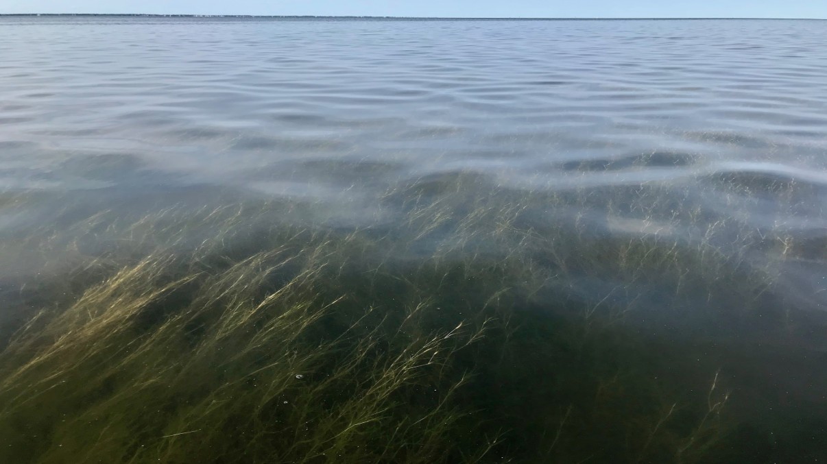
Since the 1930s, there has been a steady decline of the estuary’s eelgrass population. Because of the importance of this species, and the role it plays within the ecosystem, PEP continues to dedicate its efforts towards research, management, and future restoration of eelgrass in the Peconic Estuary.
Once bountiful throughout the Peconic Estuary, eelgrass has declined significantly over the last century. In 1930, there were more than 8,700 acres of eelgrass beds in the estuary. In 2014, less than 1,000 acres remained—a decline of more than 85 percent. Aside from a meadow in Bullhead Bay, no eelgrass persists in the Peconic Estuary west of Shelter Island. Loss of eelgrass beds affects the many commercial and recreational fish and invertebrate species that rely on them for food and shelter. An eelgrass disease epidemic along the Atlantic seaboard in the 1930s and a series of harmful algal blooms in the Peconic Estuary in the 1980s and 1990s were major factors in the loss of eelgrass habitat. Globally, seagrasses have decreased dramatically in the last few decades, and climate change is believed to play a major role. Warmer water temperatures stress eelgrass and may render historical locations of eelgrass beds no longer suitable for eelgrass growth.
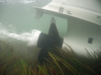
Long-term monitoring in the Peconic Estuary indicates that water temperatures in the western section of the estuary no longer fall within the optimal range for eelgrass. Rising sea level is another threat to eelgrass survival in locations where seawalls and other types of shoreline hardening make it impossible for eelgrass beds to shift landward to remain in a favorable water depth. In addition, nutrient enrichment, algal blooms, water quality, boating and fishing practices, and shoreline stabilization structures are all collectively threatening the health and extent of eelgrass. The picture shows a boat propeller harming an eelgrass bed. Over the last decade eelgrass restoration has been attempted at multiple sites within the Peconic Estuary. PEP is actively working on understanding suitable environmental conditions for eelgrass growth to better inform eelgrass protection and restoration efforts
From 1997 to 2021, PEP produced annual seagrass monitoring on a select section of beds to determine shoot density and environmental conditions such as light availability and temperature. This resulted in a long-term, quantitative data set. In 2024, PEP produced a story map with all of the historical information collected to allow our state and local government partners to better understand this important marine habitat. The story map is available here. PEP has also produced aerial surveys of the Peconic region to quantitatively assess the seagrass beds in order to inform management decisions in the Peconic Bays. The aerial imagery can be found here.
In 2023, the PEP Technical Advisory Committee voted to reassess monitoring efforts to align with regional efforts. With our partners from the Stony Brook University Geospatial Center and the University of Maryland Center for Environmental Science (UMCES), the Peconic Estuary Seagrass Story Map was created to show the visual and spatial changes of eelgrass within the estuary overtime.
The Peconic Estuary Partnership has worked closely with researchers and regulators from Stony Brook University, the New York State Department of Environmental Conservation, and UMCES, to establish an annual eelgrass monitoring strategy. Since the last aerial survey conducted in 2014, the Peconic Estuary has seen ~7.5% loss in eelgrass habitat. By incorporating the methodology of SeagrassNET, PEP will contribute important, quantitative, seasonal data to log and determine trends of the local seagrass populations. This annual monitoring initiative will engage researchers, regulators, and communities by providing access to information that can be used to guide eelgrass protection within the Peconic Estuary.
PEP is working with its regional partners to coordinate aerial flyovers in order to continue determining the trends in eelgrass habitat overtime. As of 2024, our most recent assessment has confirmed about 800.6 acres of eelgrass within the estuary. In the aerial map above, eelgrass are delineated and green areas represent continuous eelgrass beds and yellow areas represent where eelgrass is either not continuous or separated by boulders. This data also highlights where widgeon grass (Ruppia sp.) is prevalent. Widgeon grass is another type of marine vegetation similar to Z. marina yet has not been historically monitored in the estuary.
SeagrassNet is the largest and longest-running seagrass monitoring program in the world and is now housed at the Center for Coastal Studies in Cape Cod, Massachusetts. It has collected data throughout the region including at Fire Island National Seashore, Long Island Sound (Fisher’s Island), Nantucket, and throughout much of southern New England. Further, SeagrassNet maintains its own public-facing database and submission portal and can manage and serve data to the global research community. Thus, SeagrassNet provides the ideal design for monitoring in the Peconic Estuary by incorporating key indicators of seagrass condition, maintaining continuity with legacy datasets, assuming some data curation responsibilities, and coordinating with other regional monitoring programs.
PEP has also launched a Citizen Science Seagrass Monitoring Protocol to provide Peconic-wide community groups with a step-by-step monitoring program and to engage continued interest in the health and changes of their local eelgrass beds. Citizen Science SeagrassNET sites are starred on the map below.
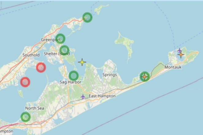
Click image to read more about PEP’s Seagrass Monitoring Strategy!
Through the success of the Coastal Watershed Grant, it was determined that pockets of cooled, groundwater could provide areas of suitable conditions for seagrass growth. With this development, PEP continues to engage its partners at Old Dominion University and Stony Brook University to continue to map groundwater pores throughout the remaining areas of the estuary, and to monitor and expand seagrass restoration within these areas.
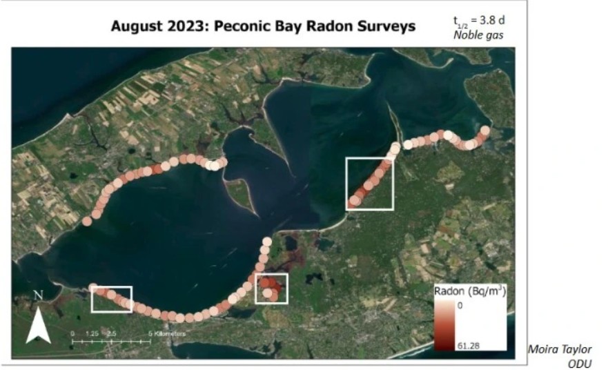
Click image to read the full groundwater study!
Negative interactions between boaters and eelgrass can be prevented. To avoid leaving prop scars in critical seagrass habitat, check out PEP’s new educational signage for eelgrass protections!

