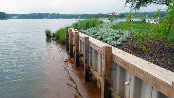
Results of Hardened Shoreline Validation Project
The results of this hardened shoreline validation project, in combination with the Horseshoe Crab Workgroup and eventual Horseshoe Crab Management Strategy, will aid PEP in the development of a Shoreline Management Model (SMM) to better support and inform decision-making for the agencies and municipalities that manage the shoreline resources.
The SMM is a novel, geospatial technique used to model existing and potential future conditions along a shoreline and to recommend best management practices for shoreline protection by considering a variety of factors. Such factors include wave energy, sediment type and movement patterns, submerged aquatic vegetation, value of the shoreline as wildlife habitat, risk of climate-change related impacts such as flooding, storm surge, and sea level rise. By weighing these factors, managers are better equipped to recommend the most appropriate shoreline protection strategy for a specific area. Ideal strategies minimize impact to ecosystems and aid in identification of areas where nature-based solutions may be more suitable than conventional hardened shoreline structures to maintain the ecological and structural integrity of the shoreline, as well as riparian rights for the surrounding community.
Additionally, the development of a Horseshoe Crab Management Strategy will enhance this model by allowing PEP and shoreline resource managers to incorporate information on preferred nesting habitats for this important species. This will better protect these ecologically active shorelines from development and to ensure that essential intertidal and salt marsh habitat is prioritized for preservation.